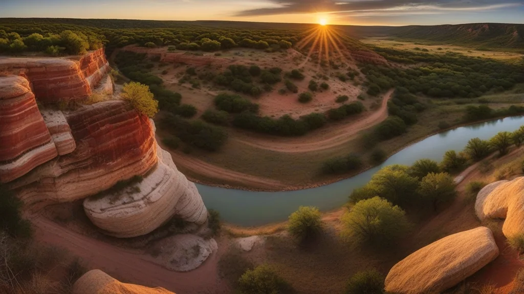

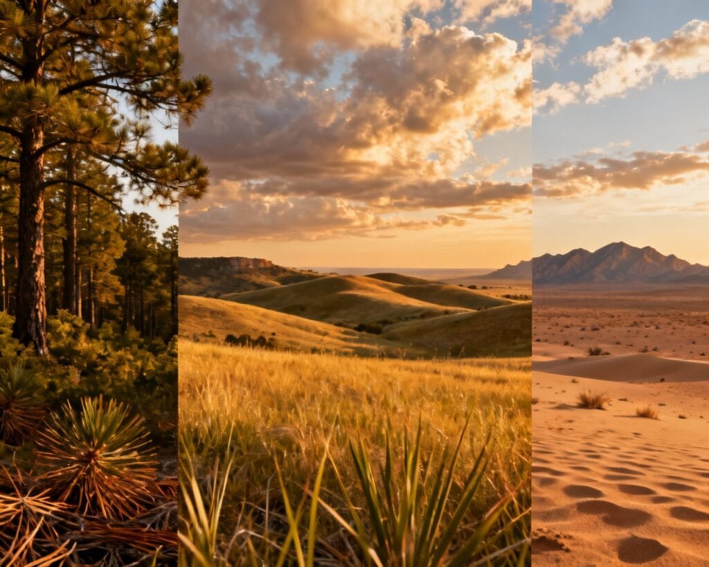
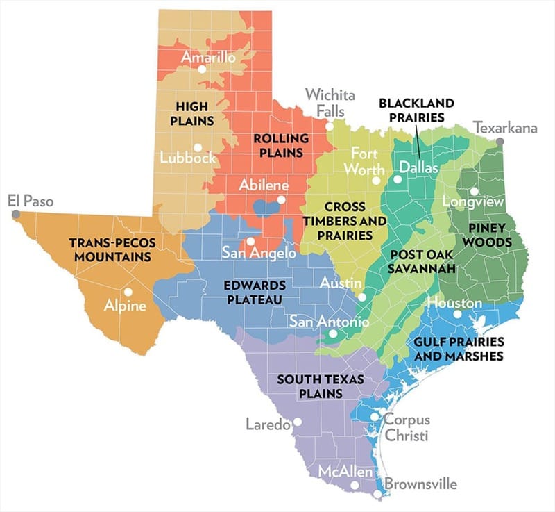
Texas spans more territory than most people realize—268,596 square miles of dramatically different landscapes. From the humid forests of East Texas to the Chihuahuan Desert of the Trans-Pecos, the Lone Star State contains 10 distinct ecoregions, each with its own climate, geology, flora, and fauna. Understanding these texas ecoregions helps you appreciate why a road trip from Houston to El Paso feels like crossing multiple states. In addition to these texas ecoregions, the diversity of wildlife and plant life found here is astonishing. The ecological significance of texas ecoregions cannot be overstated.
In this comprehensive guide, you’ll discover:
As we explore the different texas ecoregions, we’ll uncover the unique traits that define each one.
Each of the texas ecoregions offers a glimpse into the biodiversity that thrives within the state, making them essential for understanding Texas’s environmental history.
As we delve deeper into the fascinating world of texas ecoregions, you’ll gain insights into their unique characteristics and the importance of preserving them.
- What defines each of Texas’s 10 ecoregions
- The native plants and wildlife unique to each region
- Best places to experience each ecosystem
- Conservation challenges facing Texas landscapes
Whether you’re planning a nature trip, studying Texas ecology, or simply curious about the land you call home, this guide will transform how you see the state.
What Are Ecoregions?
Learning about these texas ecoregions equips you with the knowledge needed to appreciate the intricate ecosystems present in Texas.
An ecoregion is a large area defined by its climate, geology, soil, and native species. Unlike political boundaries, ecoregions follow ecological patterns—where certain plants grow, which animals thrive, and how the land behaves.
Exploring these texas ecoregions not only enhances our understanding of the state’s ecological diversity but also emphasizes the need for conservation efforts. Each of the 10 ecoregions contributes to the overall health of Texas’s environment.
Texas Parks and Wildlife Department (TPWD) officially recognizes 10 ecoregions within Texas. These regions range from the wettest (Piney Woods at 56 inches of annual rainfall) to the driest (Trans-Pecos at under 10 inches). Each supports distinct ecological communities that have evolved over thousands of years.
KEY TAKEAWAY: Texas contains more ecological diversity than any other state except California. Its 10 ecoregions span temperate forests, prairies, deserts, and coastal wetlands—all within one state’s borders.
These efforts are crucial for the survival of the unique flora and fauna found in texas ecoregions.
The 10 Texas ecoregions are:
- Piney Woods
- Gulf Prairies and Marshes
- Post Oak Savannah
- Blackland Prairie
- Cross Timbers
- South Texas Plains
- Edwards Plateau (Hill Country)
- Rolling Plains
- High Plains
- Trans-Pecos
Let’s explore each one.
Texas ecoregions are vital for maintaining biodiversity, and understanding them can help citizens advocate for their protection.
Each of Texas’s ecoregions plays a crucial role in the ecosystem, and together they form a complex web of life unique to the Lone Star State. Knowing more about these texas ecoregions will help foster a greater appreciation for Texas’s natural beauty.
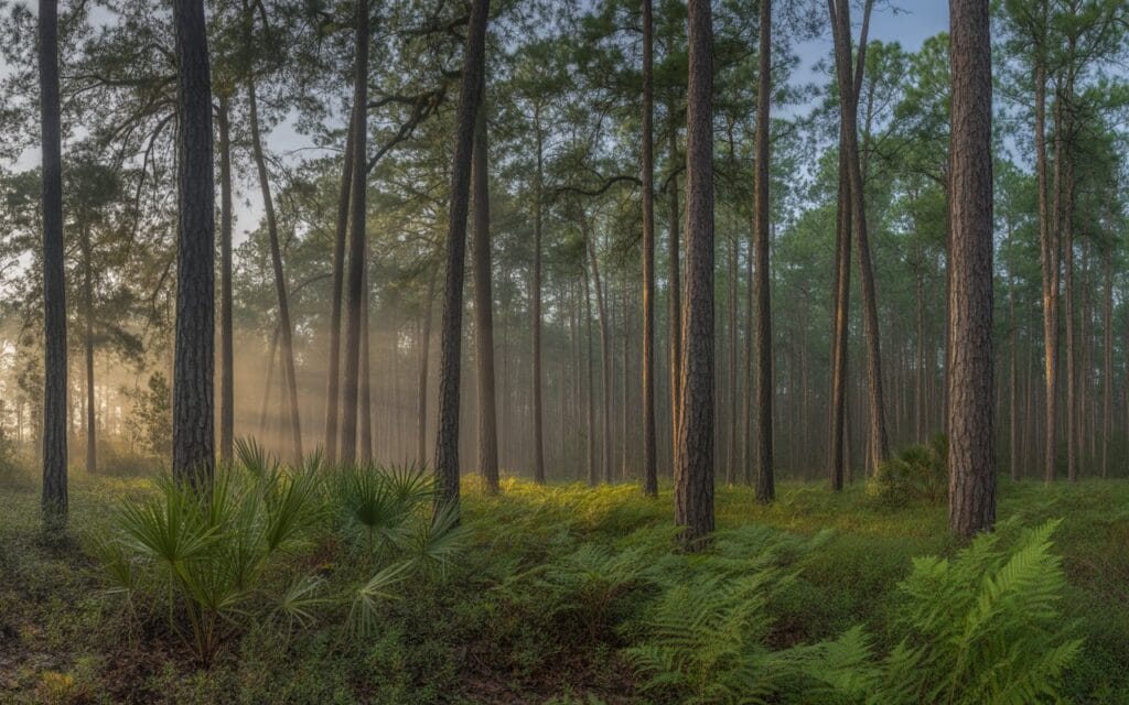
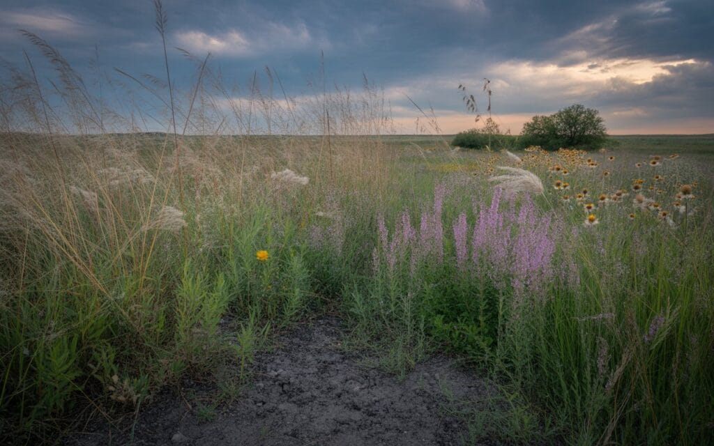
1. Piney Woods
The Piney Woods covers approximately 16 million acres of East Texas, stretching from the Louisiana border west to the edge of the Post Oak Savannah. This is the only region of Texas where you’ll find extensive pine forests—a landscape that looks more like the Deep South than the stereotypical Texas of cattle ranches and deserts.
Geography and Climate
The Piney Woods receives 40-56 inches of rainfall annually, making it Texas’s wettest ecoregion. The terrain features rolling hills, creek bottoms, and extensive bottomland hardwood forests. Red, sandy soils dominate the uplands, while clay soils characterize the river bottoms.
Native Plants
The region takes its name from four dominant pine species:
- Longleaf Pine (Pinus palustris) – Once covered 90 million acres across the South, now reduced to scattered remnants
- Shortleaf Pine (Pinus echinata) – Most widespread pine in East Texas
- Loblolly Pine (Pinus taeda) – Fast-growing commercial species
- Slash Pine (Pinus elliottii) – Found in the southernmost portions
Understory plants include American Beautyberry (Callicarpa americana), Flowering Dogwood (Cornus florida), and carnivorous species like the Sundew (Drosera spp.) in bog habitats.
Wildlife
By understanding the characteristics of texas ecoregions, you’ll be better prepared to engage in conservation efforts.
In doing so, we honor the legacy of the diverse texas ecoregions that shape our state.
The Piney Woods supports species found nowhere else in Texas:
- Red-cockaded Woodpecker (Leuconotopicus borealis) – Federally endangered, requires old-growth longleaf pine
- Louisiana Pine Snake (Pituophis ruthveni) – Threatened species of sandy uplands
- American Black Bear (Ursus americanus) – Recolonizing East Texas after decades of absence
WHERE TO SEE: Big Thicket National Preserve protects 113,000 acres of biological crossroads where eastern hardwood forests, Gulf coastal plains, and Midwest prairies converge.
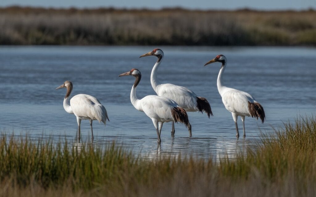
2. Gulf Prairies and Marshes
The Gulf Prairies and Marshes form a narrow band along the Texas coast, stretching 60 miles inland from the Gulf of Mexico. This ecoregion encompasses coastal prairies, salt marshes, barrier islands, and freshwater wetlands—critical habitats for migratory birds and marine life.
Geography and Climate
Flat terrain and heavy clay soils define this region. Annual rainfall ranges from 30-50 inches, with frequent hurricanes reshaping the coastal landscape. The region includes major bay systems (Galveston, Matagorda, Corpus Christi) and barrier islands (Padre Island, Galveston Island).
Native Plants
Coastal prairie once covered millions of acres:
- Gulf Cordgrass (Spartina spartinae) – Dominant in salt marshes
- Seacoast Bluestem (Schizachyrium littorale) – Coastal prairie grass
- Live Oak (Quercus virginiana) – Iconic coastal tree
- Sea Ox-eye Daisy (Borrichia frutescens) – Salt-tolerant wildflower
Wildlife
The Texas coast serves as a critical corridor for the Central Flyway:
- Whooping Crane (Grus americana) – Endangered, winters at Aransas National Wildlife Refuge
- Kemp’s Ridley Sea Turtle (Lepidochelys kempii) – World’s most endangered sea turtle, nests on Texas beaches
- Roseate Spoonbill (Platalea ajaja) – Distinctive pink wading bird
PRO TIP: Visit during spring migration (March-May) when millions of songbirds make landfall after crossing the Gulf of Mexico. High Island and the Upper Texas Coast Birding Trail offer world-class birdwatching.
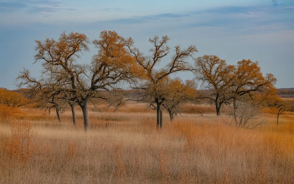
3. Post Oak Savannah
The Post Oak Savannah forms a transition zone between the eastern forests and the western prairies. This 8.5-million-acre region runs in a north-south band through Central Texas, characterized by scattered oak woodlands interspersed with tallgrass prairie.
Geography and Climate
Gently rolling terrain with sandy loam soils overlying clay. Annual rainfall averages 35-45 inches—enough to support trees but not dense forests. Fire historically maintained the open savannah character.
Native Plants
The region’s namesake tree dominates:
- Post Oak (Quercus stellata) – Drought-tolerant oak with distinctive cross-shaped leaves
- Blackjack Oak (Quercus marilandica) – Often found with post oak
- Eastern Gamagrass (Tripsacum dactyloides) – Tall bunchgrass of prairie openings
- Little Bluestem (Schizachyrium scoparium) – Copper-colored fall grass
Wildlife
The savannah mosaic supports both woodland and prairie species:
- Northern Bobwhite (Colinus virginianus) – Quail of brushy edges
- Eastern Wild Turkey (Meleagris gallopavo silvestris) – Found in oak woodlands
- Texas Horned Lizard (Phrynosoma cornutum) – State reptile, increasingly rare
KEY TAKEAWAY: The Post Oak Savannah is one of Texas’s most endangered ecosystems. Urban sprawl from Houston, Austin, Dallas, and San Antonio has fragmented much of this habitat.
4. Blackland Prairie
The Blackland Prairie once stretched as a continuous tallgrass sea from San Antonio to the Red River. Today, less than 1% of this original prairie remains—making it one of North America’s most endangered ecosystems. The I-35 corridor runs directly through this region.
Geography and Climate
The region takes its name from the dark, fertile Houston Black clay soils that made it irresistible to agriculture. These heavy clay soils shrink and swell dramatically with moisture changes. Annual rainfall averages 30-40 inches.
Native Plants
True prairie plants dominated before European settlement:
- Big Bluestem (Andropogon gerardii) – “King of the prairie,” grew 6-8 feet tall
- Indiangrass (Sorghastrum nutans) – Golden-plumed tallgrass
- Switchgrass (Panicum virgatum) – Native bunchgrass
- Gayfeather (Liatris spp.) – Purple fall-blooming wildflower
Wildlife
Prairie-dependent species struggle in this fragmented landscape:
- Greater Prairie-Chicken (Tympanuchus cupido) – Extirpated from Texas
- Dickcissel (Spiza americana) – Grassland songbird, declining
- Northern Harrier (Circus hudsonius) – Low-flying prairie hawk
WARNING: Authentic Blackland Prairie is nearly impossible to find. Most “prairie” in this region has been converted to agriculture or has grown into brush without fire. The Blackland Prairie Raptor Center and Clymer Meadow Preserve protect small remnants.
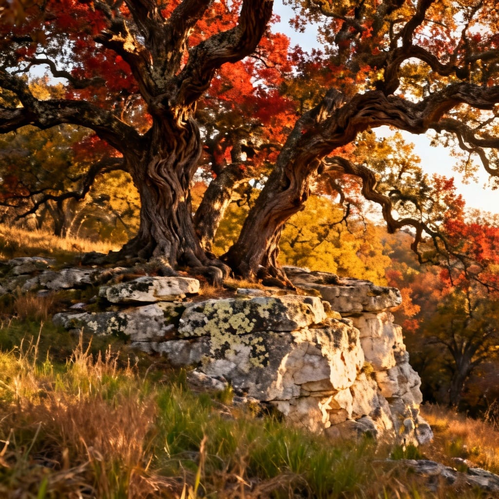
5. Cross Timbers
The Cross Timbers region earned its name from early travelers who had to “cross the timbers”—dense bands of oak forest that interrupted the prairies. This 15-million-acre ecoregion stretches through North-Central Texas from the Red River south to the Edwards Plateau.
Geography and Climate
The terrain alternates between wooded hills with sandy soils and open prairies with clay soils. Annual rainfall averages 25-35 inches—the transition point where trees can survive but don’t dominate.
Native Plants
A distinctive mix of eastern and western species:
- Post Oak (Quercus stellata) – Dominant tree
- Blackjack Oak (Quercus marilandica) – Stunted, drought-adapted
- Ashe Juniper (Juniperus ashei) – Expanding due to fire suppression
- Sideoats Grama (Bouteloua curtipendula) – Texas state grass
Wildlife
The Cross Timbers provide crucial habitat for:
- Eastern Fox Squirrel (Sciurus niger) – Common in oak woodlands
- Wild Turkey (Meleagris gallopavo) – Thrives in oak-grassland mosaic
- Texas Alligator Lizard (Gerrhonotus infernalis) – Rocky woodland species
WHERE TO SEE: Lake Mineral Wells State Park and Dinosaur Valley State Park showcase the Cross Timbers landscape. The ancient oaks at Cross Timbers Trail are some of the oldest living organisms in Texas.
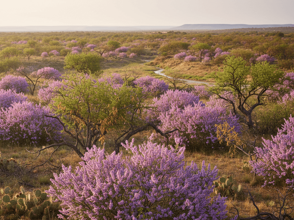
6. South Texas Plains
The South Texas Plains—also called the Brush Country or Rio Grande Plain—covers 20 million acres of thorny shrubland from San Antonio to the Rio Grande. This region supports unique species found nowhere else in the United States, thanks to its subtropical climate and Mexican ecological connections.
Geography and Climate
Flat to gently rolling terrain with caliche soils. Rainfall decreases from east (25 inches) to west (15 inches). Summer temperatures regularly exceed 100°F. The Rio Grande forms the southern boundary.
Native Plants
Dense thornscrub characterizes the region:
- Honey Mesquite (Prosopis glandulosa) – Dominant shrub/tree
- Texas Ebony (Ebenopsis ebano) – Rare native with distinctive pods
- Cenizo (Leucophyllum frutescens) – Texas Sage, purple-flowered shrub
- Prickly Pear (Opuntia spp.) – Multiple species throughout
Wildlife
Mexican species reach their northern limits here:
- Ocelot (Leopardus pardalis) – Endangered wild cat, fewer than 100 remain in Texas
- Green Jay (Cyanocorax yncas) – Tropical species, common at feeders
- Texas Tortoise (Gopherus berlandieri) – State-threatened desert tortoise
- Javelina (Pecari tajacu) – Collared peccary, native to region
PRO TIP: The World Birding Center network includes 9 sites along the Rio Grande where you can see Mexican species rarely found elsewhere in the U.S. Spring is peak migration season.
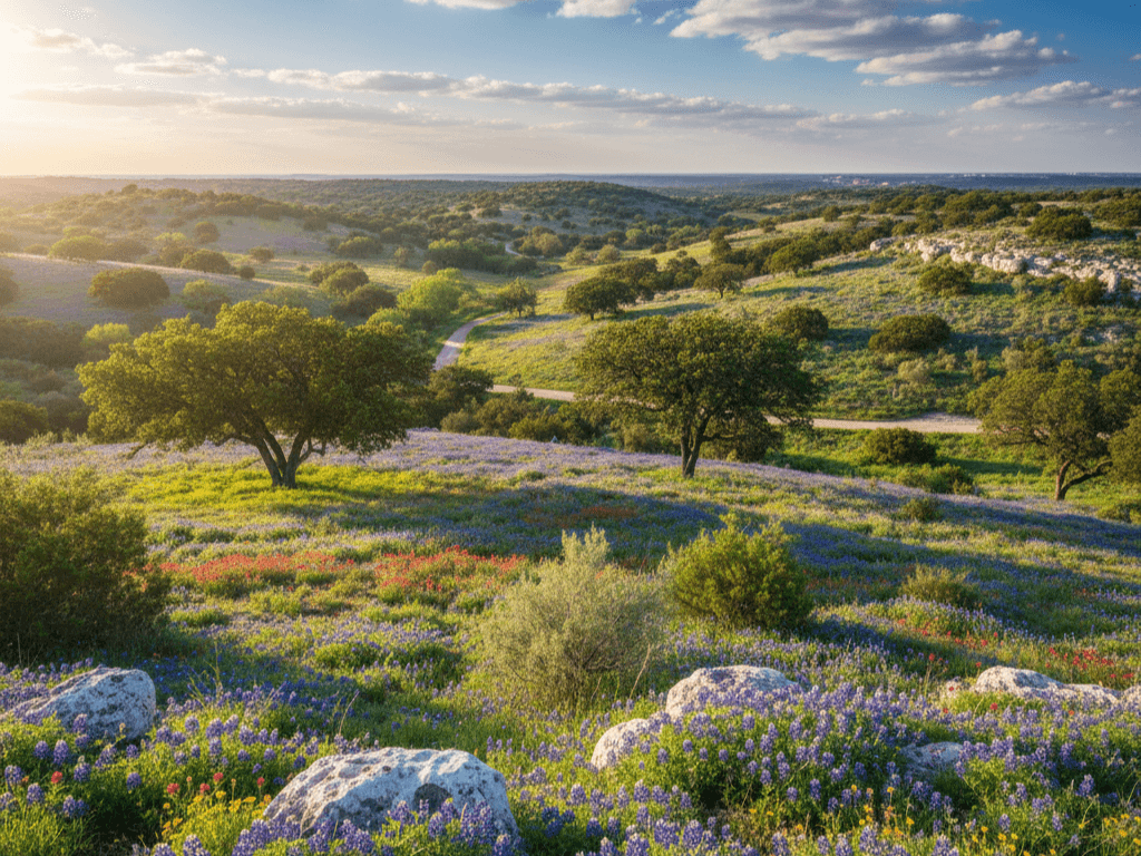
7. Edwards Plateau (Hill Country)
The Edwards Plateau—commonly called the Texas Hill Country—is perhaps Texas’s most beloved ecoregion. This 24-million-acre limestone plateau features spring-fed rivers, scenic canyons, wildflower meadows, and the distinctive cedar-covered hills that define Central Texas.
Geography and Climate
The Balcones Escarpment forms the eastern boundary, where the plateau drops dramatically to the coastal plains. Thin, rocky soils overlie porous Edwards limestone. Annual rainfall averages 20-33 inches, but much infiltrates quickly into the aquifer. Underground rivers and caverns are common.
Native Plants
A unique mix adapted to thin, limestone soils:
- Ashe Juniper (Juniperus ashei) – Called “cedar” locally, now dominant
- Texas Red Oak (Quercus buckleyi) – Endemic species with brilliant fall color
- Texas Bluebonnet (Lupinus texensis) – State flower, peaks in April
- Agarito (Mahonia trifoliata) – Yellow-flowered shrub with edible berries
Wildlife
Karst features create unique habitats:
- Golden-cheeked Warbler (Setophaga chrysoparia) – Federally endangered, breeds only in Central Texas
- Black-capped Vireo (Vireo atricapilla) – Endangered songbird of scrubby hillsides
- Texas Blind Salamander (Eurycea rathbuni) – Endangered cave species
- Mexican Free-tailed Bat (Tadarida brasiliensis) – Millions roost under Austin bridges
KEY TAKEAWAY: The Edwards Aquifer, which underlies the plateau, provides drinking water for over 2 million Texans and feeds iconic springs like Barton Springs, San Marcos Springs, and Comal Springs. Protecting this groundwater is critical.
8. Rolling Plains
The Rolling Plains stretch across 24 million acres of West-Central Texas, forming a transition between the High Plains to the west and the Cross Timbers to the east. This is classic ranching country—mesquite-dotted grasslands broken by red sandstone breaks and gypsum outcrops.
Geography and Climate
Gently rolling terrain with red clay and sandy loam soils. Rivers like the Brazos and Red have carved dramatic breaks into the soft rock. Annual rainfall averages 20-28 inches, mostly in spring and fall.
Native Plants
A mix of shortgrass and midgrass prairie species:
- Blue Grama (Bouteloua gracilis) – Dominant shortgrass
- Honey Mesquite (Prosopis glandulosa) – Has increased dramatically since settlement
- Sand Plum (Prunus angustifolia) – Shrubby thicket-former
- Buffalo Grass (Bouteloua dactyloides) – Low-growing sod-former
Wildlife
As we examine the diverse landscapes within texas ecoregions, it’s important to recognize the interconnections that exist among them.
Prairie and rangeland species dominate:
- Pronghorn (Antilocapra americana) – North America’s fastest land mammal
- Lesser Prairie-Chicken (Tympanuchus pallidicinctus) – Threatened grassland grouse
- Ferruginous Hawk (Buteo regalis) – Large prairie raptor
- Texas Horned Lizard (Phrynosoma cornutum) – Still relatively common here
WHERE TO SEE: Caprock Canyons State Park showcases the dramatic escarpment between the Rolling Plains and High Plains, with a free-roaming bison herd and stunning red canyon scenery.
9. High Plains
The High Plains occupy the Texas Panhandle—a vast, flat tableland known as the Llano Estacado or “Staked Plains.” This 20-million-acre region is the southernmost extension of the Great Plains, characterized by treeless grasslands, dramatic weather, and the Ogallala Aquifer.
Geography and Climate
Remarkably flat terrain at 3,000-4,500 feet elevation. Deep, fertile soils overlie the Ogallala Aquifer. Annual rainfall averages 15-21 inches. Temperature extremes are notable: summers reach 100°F, winters drop below 0°F.
Native Plants
Short-grass prairie species dominate:
- Blue Grama (Bouteloua gracilis) – Primary grass
- Buffalo Grass (Bouteloua dactyloides) – Sod-forming grass
- Yucca (Yucca spp.) – Sword-leaved rosettes
- Sand Sage (Artemisia filifolia) – Silvery shrub of sandy areas
Wildlife
Open grassland species characteristic of the Great Plains:
- Swift Fox (Vulpes velox) – Small prairie fox, rare in Texas
- Black-tailed Prairie Dog (Cynomys ludovicianus) – Keystone species, colonies support many predators
- Mountain Plover (Charadrius montanus) – Winters on plowed fields
- Burrowing Owl (Athene cunicularia) – Uses prairie dog burrows
WARNING: Groundwater depletion threatens the High Plains. The Ogallala Aquifer, which supports agriculture across the region, is being pumped faster than it recharges. Some areas may be depleted within decades.
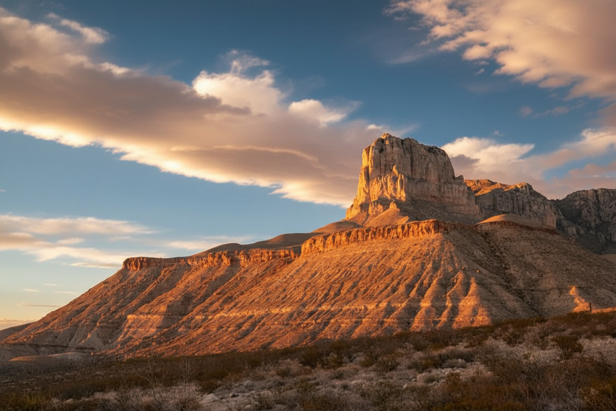
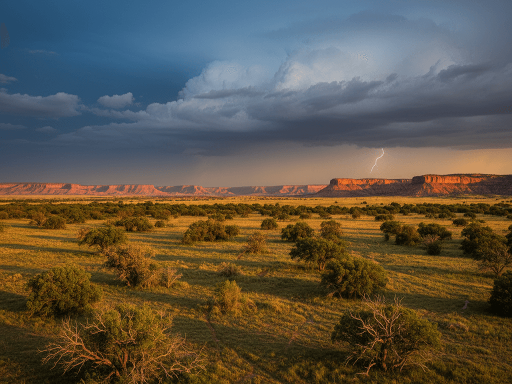
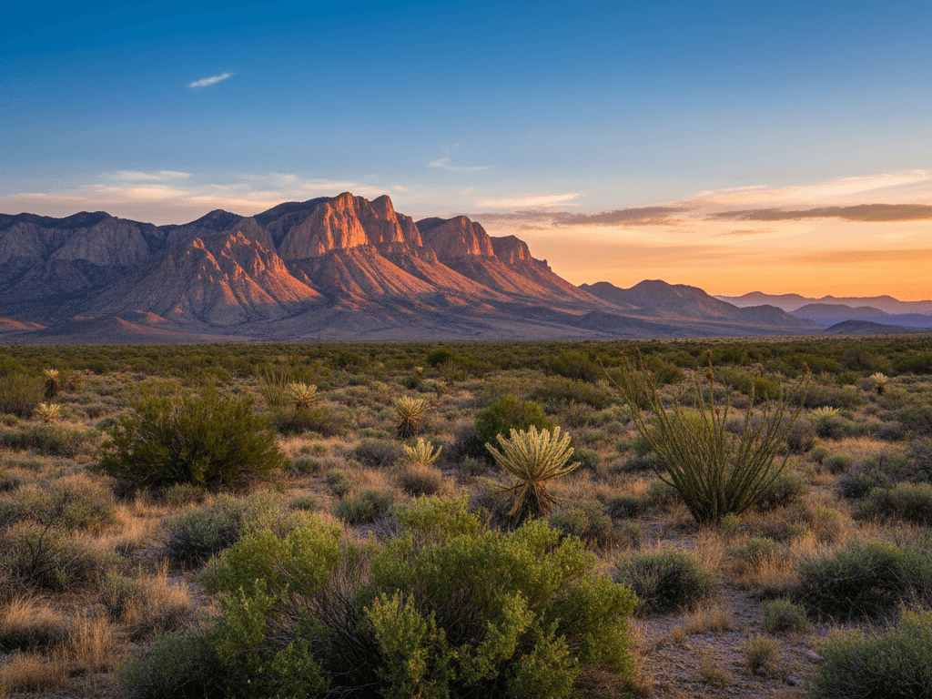
10. Trans-Pecos
The Trans-Pecos region of Far West Texas is the state’s largest, most diverse, and most rugged ecoregion. These 19 million acres encompass the Chihuahuan Desert, sky-island mountains reaching 8,749 feet (Guadalupe Peak), and the iconic landscapes of Big Bend.
Geography and Climate
Basin-and-range topography with isolated mountain chains rising from desert basins. Elevation ranges from 2,500 to 8,749 feet. Annual rainfall varies from 8 inches in the lowlands to 20 inches in the mountains. Temperature extremes are dramatic—over 100°F in summer basins, below freezing in mountain winters.
Native Plants
Desert and mountain species mix:
- Creosote Bush (Larrea tridentata) – Dominant desert shrub
- Lechuguilla (Agave lechuguilla) – Indicator species for Chihuahuan Desert
- Ocotillo (Fouquieria splendens) – Spindly desert plant with red flowers
- Ponderosa Pine (Pinus ponderosa) – In Guadalupe and Davis Mountains
- Big Tooth Maple (Acer grandidentatum) – Colorful fall foliage in canyons
Wildlife
The Trans-Pecos hosts species found nowhere else in Texas:
- Desert Bighorn Sheep (Ovis canadensis nelsoni) – Restored to several mountain ranges
- Montezuma Quail (Cyrtonyx montezumae) – Harlequin-patterned mountain quail
- Lucifer Hummingbird (Calothorax lucifer) – Mexican species, summers in Big Bend
- Trans-Pecos Rat Snake (Bogertophis subocularis) – Beautiful patterned snake of rocky canyons
PRO TIP: Visit Big Bend National Park between October and April for comfortable temperatures. The Chisos Basin area provides access to mountain species, while the Rio Grande Village area showcases desert and riparian habitats.
Conservation Challenges Across Texas Ecoregions
Texas faces significant conservation challenges across all ecoregions:
Habitat Loss and Fragmentation
- Urbanization: Texas adds 400,000+ new residents annually, primarily in the I-35 corridor (Blackland Prairie, Edwards Plateau, Post Oak Savannah)
- Agricultural Conversion: Historic prairies have been converted to cropland or improved pasture
- Energy Development: Wind and oil/gas development impact wildlife, particularly in West Texas
Invasive Species
- Feral Hogs (Sus scrofa) – Found in all ecoregions, cause billions in agricultural damage
- King Ranch Bluestem (Bothriochloa ischaemum) – Exotic grass displacing native prairies
- Chinese Tallow (Triadica sebifera) – Transforming coastal prairies and wetlands
- Giant Salvinia (Salvinia molesta) – Choking East Texas waterways
Water Issues
- Aquifer Depletion: Ogallala (High Plains) and Edwards (Hill Country) aquifers under pressure
- Spring Flow Decline: Historic springs drying up due to groundwater pumping
- Surface Water Diversion: Altered river flows affect riparian and coastal ecosystems
Climate Change
- Increased Drought Frequency: Affecting all ecoregions, particularly western regions
- Species Range Shifts: Subtropical species moving north; mountain species losing habitat
- Wildfire Risk: Extended fire seasons, particularly in Trans-Pecos and High Plains
KEY TAKEAWAY: You can support Texas ecoregion conservation by visiting state parks (fees support habitat management), supporting land trusts, reducing water use, and advocating for wildlife corridors.
Best Times to Visit Each Ecoregion
| Ecoregion | Best Season | Why |
|---|---|---|
| Piney Woods | Spring, Fall | Wildflowers, bird migration, comfortable weather |
| Gulf Prairies | Spring, Winter | Bird migration, whooping cranes, mild temperatures |
| Post Oak Savannah | Fall | Oak colors, mild weather, wildlife active |
| Blackland Prairie | Spring | Wildflowers on remnant prairies |
| Cross Timbers | Fall | Oak colors, comfortable hiking weather |
| South Texas Plains | Winter, Spring | Tropical birds, mild temperatures |
| Edwards Plateau | Spring | Bluebonnets, wildflowers, flowing springs |
| Rolling Plains | Spring, Fall | Wildflowers, comfortable temperatures |
| High Plains | Spring, Fall | Avoid summer heat and winter cold |
| Trans-Pecos | Fall, Winter, Spring | Avoid extreme summer heat |
Frequently Asked Questions
What are the 10 ecoregions of Texas?
Texas has 10 official ecoregions: Piney Woods, Gulf Prairies and Marshes, Post Oak Savannah, Blackland Prairie, Cross Timbers, South Texas Plains, Edwards Plateau (Hill Country), Rolling Plains, High Plains, and Trans-Pecos. Each has distinct climate, geology, plants, and wildlife.
What is the largest ecoregion in Texas?
The Edwards Plateau and Rolling Plains are the largest, each covering approximately 24 million acres. However, the Trans-Pecos (19 million acres) has the most dramatic landscape diversity, from desert basins to 8,749-foot peaks.
Which Texas ecoregion has the most biodiversity?
The Piney Woods and Trans-Pecos rival for biodiversity, though in different ways. The Piney Woods has the highest species density, while the Trans-Pecos has unique species found nowhere else due to isolated mountain habitats. Big Thicket is called the “biological crossroads of North America.”
What ecoregion is Austin in?
Austin sits at the intersection of three ecoregions: the Edwards Plateau (Hill Country) to the west, the Blackland Prairie to the east, and the Post Oak Savannah to the northeast. This convergence contributes to Austin’s notable biodiversity.
What ecoregion is Houston in?
Houston lies primarily in the Gulf Prairies and Marshes ecoregion, with portions of the Post Oak Savannah to the north. The Piney Woods begins about 50 miles northeast of downtown.
Which Texas ecoregion is most endangered?
The Blackland Prairie is Texas’s most endangered ecoregion, with less than 1% of original habitat remaining. The Post Oak Savannah and coastal prairie portions of the Gulf Prairies also face severe fragmentation from development.
How can I help protect Texas ecoregions?
Visit state and national parks (your fees support conservation), support land trusts like The Nature Conservancy Texas and Texas Land Conservancy, reduce water use, plant native species, and advocate for habitat corridors between protected lands.
Explore Texas Ecoregions
Texas contains an ecological diversity matched by few places on Earth. From the misty forests of the Piney Woods to the stark beauty of the Chihuahuan Desert, each ecoregion offers landscapes, plants, and wildlife you won’t find anywhere else.
Start your exploration at one of Texas’s excellent state parks—each showcases its ecoregion’s character. Pay attention to how the land changes as you drive across the state. Notice when the longleaf pines give way to post oaks, when the rolling hills flatten into prairie, when the mesquite-dotted plains yield to creosote desert.
Understanding texas ecoregions transforms every road trip into a journey through ecological time and space. The more you learn about texas ecoregions, the more you’ll see—and the more you’ll want to protect these remarkable landscapes for future generations.
Related Guides:
- Piney Woods Ecoregion Guide
- Edwards Plateau (Hill Country) Guide
- Texas Native Plants
- Texas Wildlife Overview
In summary, the rich tapestry of texas ecoregions offers a glimpse into the environmental heritage of Texas. Understanding these ecosystems is essential for future conservation efforts.
By exploring these texas ecoregions, we can better appreciate Texas’s ecological significance and the need for protective measures.
Visiting these texas ecoregions is a fantastic way to observe the rich biodiversity of the state.